The Four Doors into the Bay
Every few weeks someone messages me from the queue at a Kona coffee shack, phone in hand, asking why the satnav has dumped them in a village with no water in sight. Kealakekua Bay does that to people. It has three separate entrances that visitors routinely confuse, plus a fourth that only exists if you own proper walking boots.
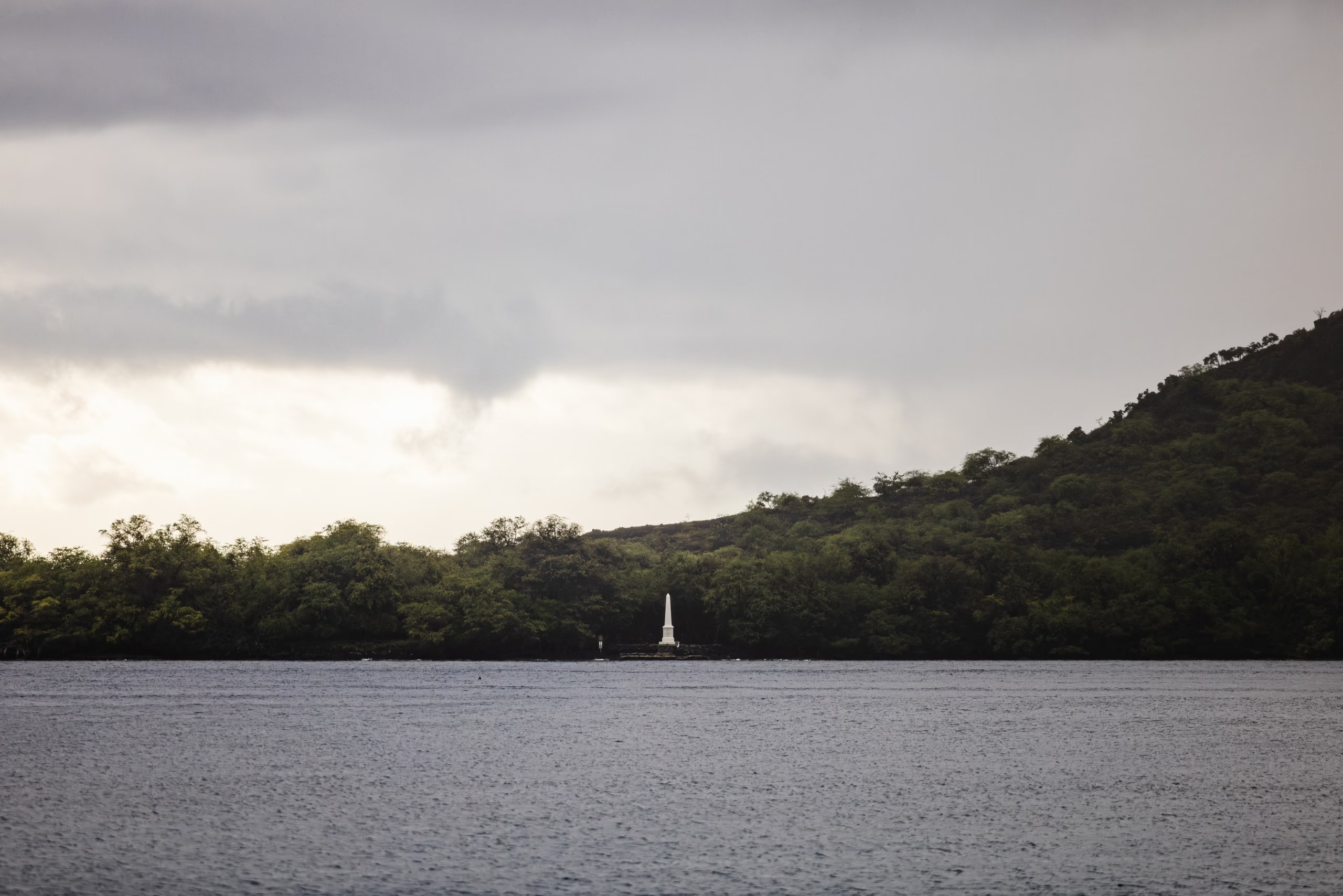
Here is the plain truth. There is no road to the Captain Cook Monument. Not a dirt track, not a service lane, not a cheeky little shortcut behind a gate. The obelisk stands on a shelf of black rock at Kaʻawaloa (kah-AH-vah-LOH-ah), on the north arm of the bay, and you get there on foot, by boat, or paddling a kayak. Cars stop at Nāpōʻopoʻo (nah-POH-oh-POH-oh) on the southern shore, but that car park is not the trailhead. The Kaʻawaloa Trail begins 3.5 miles back up the road on Highway 11, and from there it is 3.8 miles round trip to the monument.
Four doors, then. Drive to the southern shore and snorkel from the rocks. Walk the Kaʻawaloa Trail down 1,300 vertical feet. Book a catamaran or raft out of Keauhou Bay. Or rent a permitted kayak and paddle across. Each one costs a different amount of money and a very different amount of thigh.
Access Routes at a Glance
I built this table after one too many conversations that began with “so we can just drive to the monument, yeah?” Print it, screenshot it, do whatever you do with screenshots.
| Route | Time from Kailua-Kona | Cost | Fitness / Effort |
|---|---|---|---|
| Car to Nāpōʻopoʻo Beach Park (southern shore) | 35 to 45 minutes, 12 to 17 miles | Parking free ($0.00 / €0.00) | Low. Five minutes on foot from the car to the shoreline. |
| Kaʻawaloa Trail on foot to the monument | 20 minutes by road, then 40 to 50 minutes down | Free ($0.00 / €0.00) | High. 1,300 feet of climbing on the way back, 60 to 90 minutes. |
| Tour boat from Keauhou Bay | 15 to 20 minutes by road, then 25 to 35 minutes at sea | €74 to €179 (~$80 to $193) | Low to moderate. You sit down a lot. |
| Kayak from the Nāpōʻopoʻo shoreline | 35 to 45 minutes by road | €46 to €65 (~$50 to $70) rental; guided trips cost more | Moderate to high. Roughly 1.5 miles of open-water paddling each way. |
Where the Bay Actually Sits (and Why the Postcode Matters)
Pin these numbers into your phone before you leave the hotel: 19°28′34″N, 155°55′37″W. That puts Kealakekua Bay in the South Kona District of Hawaiʻi County, postcode 96704, roughly 12 miles south of Kailua-Kona town as the crow flies and a good deal further by road.
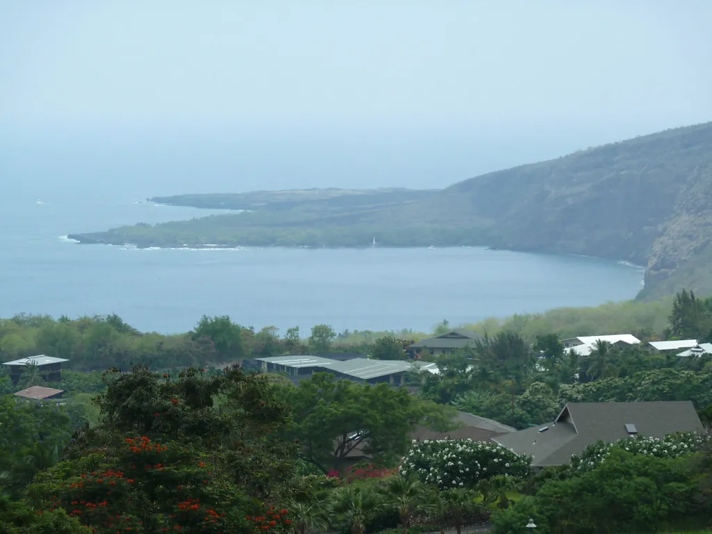
The old Hawaiian land divisions explain the confusion better than any map app. Kaʻawaloa is the northern arm, where the monument and the cliff face of Pali Kapu o Keōua rise out of the water. Kealakekua and Nāpōʻopoʻo sit on the southern and eastern edges, and that is where the road, the car park and the picnic pavilion live. Two halves of one bay, with a 3.8-mile round-trip trail and about 1,300 feet of elevation between them.
Now the classic trap. Type “Captain Cook” into a rental car’s satnav and you may end up in Captain Cook village, up on the highway, four miles inland and slightly baffled. Type “Kealakekua” and you land in Kealakekua town, also inland. Neither is the bay. What you want is Nāpōʻopoʻo Beach Park, or the Kaʻawaloa Trailhead on Highway 11 if you are hiking. Two different pins, two different days out.
Arriving by Air or by Cruise Ship
By Air: KOA
Ellison Onizuka Kona International Airport at Keāhole sits 24 to 27 miles north of the bay. Route 19 south, then Route 11 through town, and you are looking at 40 to 50 minutes in normal traffic. Baggage claim at KOA is famously leisurely, and the rental car desks queue up around midday arrivals.
My honest advice: do not plan a 4pm bay arrival on the same day you fly in, especially on an inter-island hop. By the time you collect the car and drive south, the light is going and the trail is in shadow. Sleep, then swim.
Taxis and rideshares from the airport run roughly €65 to €90 (~$70 to $97) one way to Nāpōʻopoʻo, and return availability is patchy at best. Check the official KOA airport site for current ground transport listings.
By Sea: the Kailua-Kona Pier
Cruise ships anchor off Kailua-Kona and tender passengers ashore at the pier. From there to Nāpōʻopoʻo is about 13 miles and 25 to 30 minutes by road, which sounds easy until you do the maths on a short port call.
Tender queues can swallow 30 to 45 minutes of your day. Add the drive each way, and a four-hour snorkel becomes a frantic two-hour dash. The bay deserves half a day minimum. Book a ship excursion or a pre-arranged transfer rather than chancing a taxi back to the pier at 3pm.
Water-based operators run straight from Keauhou Bay, which is a shorter hop south of town. A Fair Wind II afternoon snorkel at €133 (~$154) fits neatly around a morning port arrival.
Driving Directions from Kona, Kohala and Hilo
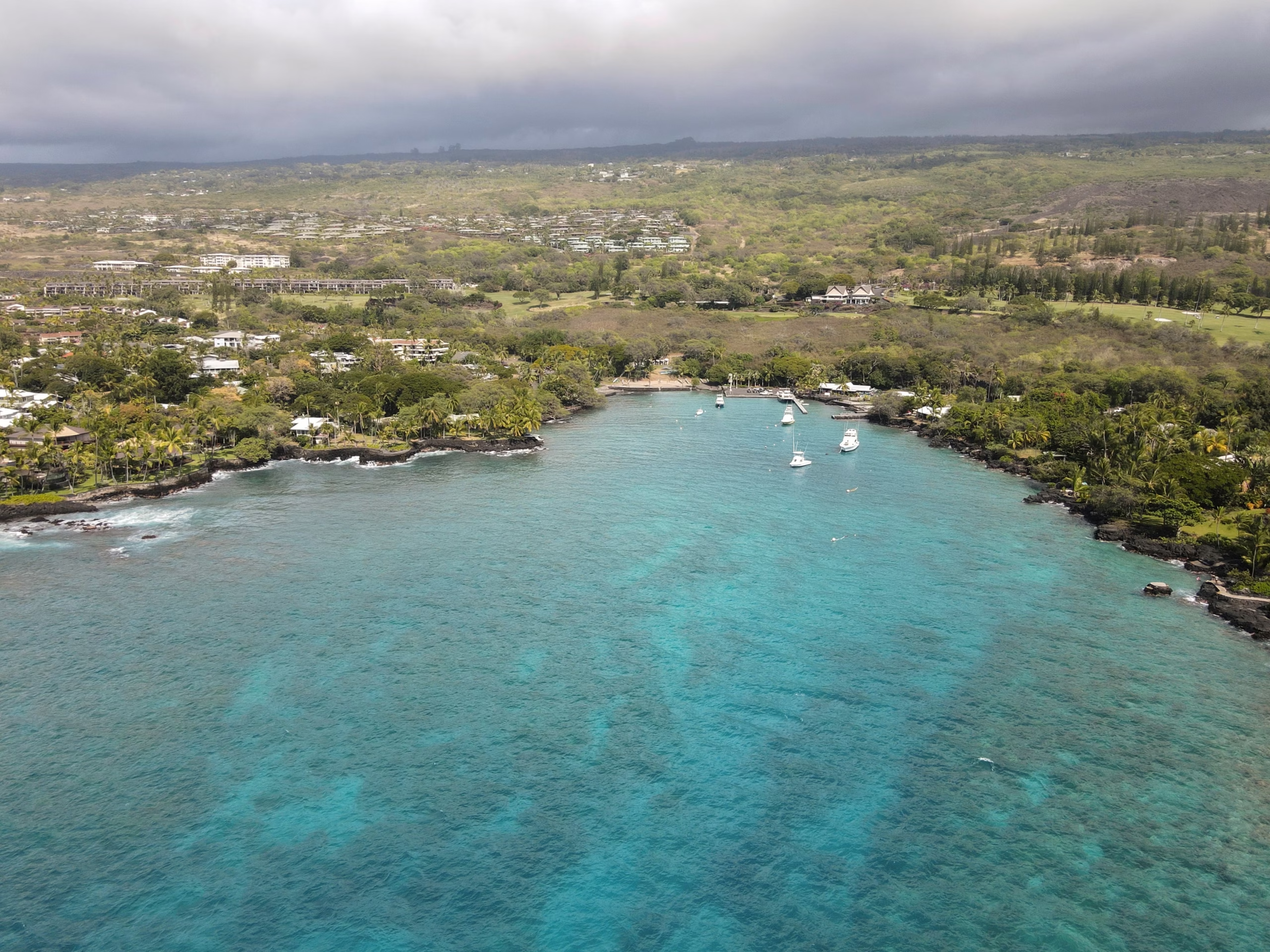
From Kailua-Kona town, head south on Route 11. You will pass through Keauhou, Kainaliu and Captain Cook village, all of which are worth a coffee stop, and after roughly 12 miles you reach the signed junction for Nāpōʻopoʻo Road. Turn makai, which means seaward, and follow it down.
The descent is where sensible drivers slow down. The road narrows to a single lane in places, swings through blind switchbacks, and is shared with residents in pickups who know it far better than you do. Pull over and let them past. You will also pass a signed viewpoint pull-out partway down, which is the easiest free Kealakekua Bay viewpoint on the island and takes about ninety seconds to enjoy.
From the windward side, Hilo is roughly 105 miles out via Route 200 (the Daniel K. Inouye Highway), so figure 2 hours 20 minutes to 2.5 hours, or about 120 miles and closer to three hours if you take Route 11 around the southern tip. Volcano sits nearer on that southern route at around 90 miles and 2 hours 15 minutes. From Waikoloa and the Kohala resorts, allow 1 hour 20 minutes to 1 hour 40 minutes. This is a full-day commitment, not a detour tacked onto a volcano morning.
Nāpōʻopoʻo Beach Park and the Wharf: Parking, Facilities, Reality
The state park is open daily from 7:00 AM to 8:00 PM and entry is free for everyone, residents and visitors alike. Two parking options exist, and both fill early.
- Nāpōʻopoʻo Beach Park lot: free, paved, holds 20 to 30 vehicles, and is routinely full by 9:00 AM at weekends. Restrooms, outdoor rinse showers and a covered picnic pavilion sit right there.
- Kaʻawaloa Trailhead shoulder: free, unpaved, 15 to 20 cars, about 500 feet west of the Highway 11 junction. This is the hiker’s car park, not the snorkeller’s.
- No overnight parking at either spot. The gates and the shoulders are not a campsite.
- Break-in risk is real. Leave luggage at the hotel, put rental paperwork out of sight, and leave the glovebox and centre console open and visibly empty. Thieves check for the easy score.
The shoreline itself is basalt boulders rather than sand, with no ADA water ramp, so reef shoes earn their keep. And one strict rule that catches people out: launching any watercraft from the historic Nāpōʻopoʻo concrete wharf is prohibited. Kayakers walk their boats in from the shoreline further along.
The Kaʻawaloa Trail: the Free Route to the Monument
This is the Kealakekua Bay hike, and it is not a stroll. Three point eight miles round trip, 1,300 vertical feet, paved for the first 100 yards and then fractured basalt, loose scree and tall Guinea grass all the way down to the water.
Going down takes 40 to 50 minutes. Coming back up takes 60 to 90, in direct sun, often above 90°F, with no shade and no water source at the bottom. Carry 2.5 to 3 litres per person plus electrolytes. Old Faithful (my mask) lives in the dry bag, but the water bottles matter more.
- Footwear: grippy trainers or hiking shoes. Flip-flops on wet basalt is how people end up at the Kona hospital.
- Start time: hikers leaving the trailhead between 6:30 and 6:45 AM reach the monument before 7:30 and get roughly two quiet hours before the boats arrive.
- Return leg: treat the climb as the main event, not an afterthought. If you are still at the bottom at 2pm, you are climbing in the hottest part of the day.
- No facilities at Kaʻawaloa Flats: no restrooms, no bins, no taps. Pack it in, pack it out.
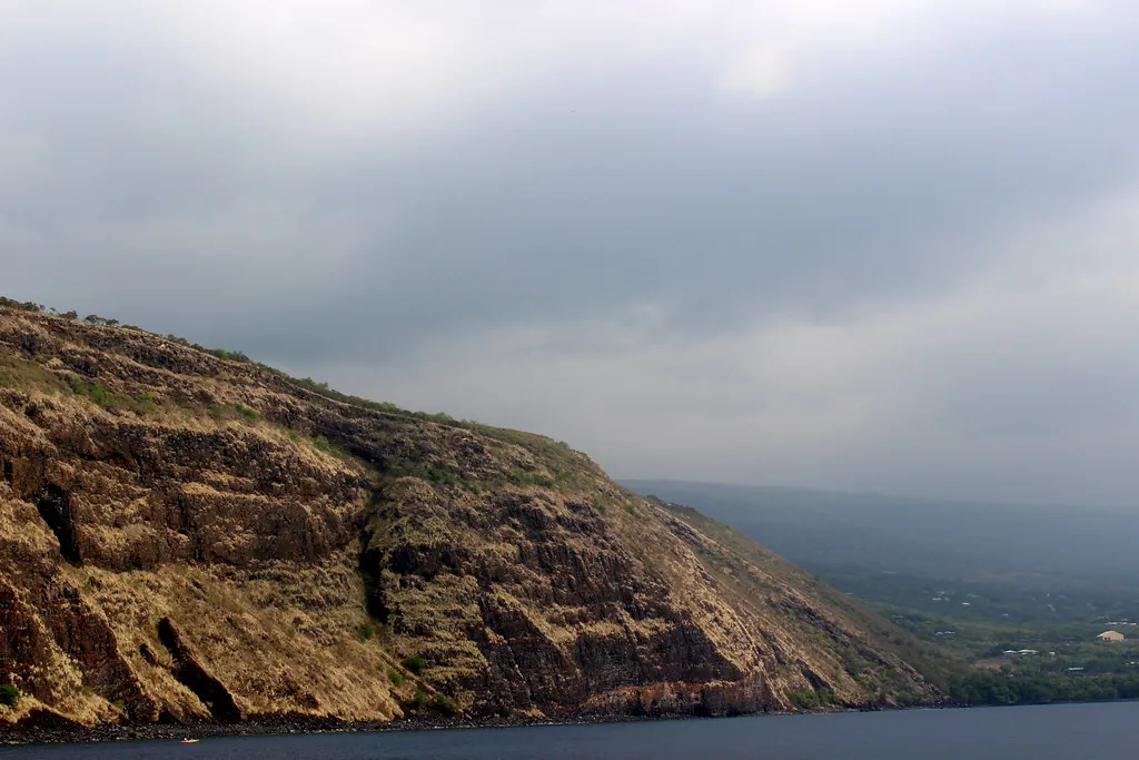
The descent is a lie. The bay hands you forty easy minutes and then asks for all of them back, in the sun, with interest.
Reaching the Monument by Water: Boats and Kayaks
Catamarans and Rafts
Commercial departures run mostly from Keauhou Bay, 7 road miles and 15 to 20 minutes from town, with a 25 to 35 minute crossing. Honokōhau Harbor sends boats too, adding roughly 20 minutes of road time.
Price band runs €74 to €179 (~$80 to $193) depending on vessel and duration. A Zodiac raft trip at €151 (~$163.14) gets you there fast and low to the water. If you want the history narrated properly, the three-hour dinner cruise at €175 (~$189.19) is a different, slower evening entirely.
Mooring rules matter. No vessel lands at Kaʻawaloa unless it belongs to one of the three permit-holding commercial operators. Swimmers enter the water about 50 feet south of the obelisk, at the concrete jetty, and no, you cannot tie up there.
Kayaks and Permits
Every vessel in the bay needs a DLNR Vessel Special Use Permit, including kayaks, SUPs and canoes. Commercial rental fleets carry a Rental Vessel Special Use Permit and must display valid decals on both sides of each bow. Check the decals before you hand over cash.
Roadside operators working out of pickup trucks will tell you otherwise. They are unlicensed, they are a known trap, and DOCARE officers patrol the water citing paddlers and confiscating boats. Only rent from licensed outfitters such as Kona Boys, and read the full picture on our kayaking and boat access hub.
Private boat owners must email [email protected] at least 14 days ahead. Unguided rental kayaks cannot land anywhere, ever. You snorkel tethered to the boat.
Timing Your Arrival Around the Boats
Crowd density here is entirely dictated by the commercial schedule, not by the weather. The 60-foot Fair Wind II leaves Keauhou between 8:30 and 9:00 AM and moors in Kaʻawaloa Cove around 9:15 to 9:30. Smaller rafts and guided kayak groups follow immediately. Between 9:45 AM and 12:30 PM you can share the cove with several large vessels and 100 to 200 snorkellers.
Two windows dodge most of it. Early morning, 7:00 to 9:00 AM, gives you flat water, horizontal visibility over 100 feet, and fish going about their morning unbothered. Then the midday lull, 1:00 to 3:30 PM, once the catamarans head home between 12:30 and 1:15. Afternoon chop cuts visibility to 40 or 50 feet, but the reef is largely yours. By 4pm the bay is empty and the light hits the cliff face properly.
If you only remember one number from this page, make it 6:45 AM at the trailhead. That single decision buys you two hours of a bay that feels privately owned.
Public Transit, Taxis and Private Shuttles
The Hele-On bus runs Route 90 along the Highway 11 corridor between Pāhala, South Kona and Kailua-Kona. Fares are currently $0.00 under a county subsidy running through at least 31 December 2028, which is genuinely remarkable. The catch is the last leg: you still walk down Nāpōʻopoʻo Road, and the walk back up is a climb on a hot shoulder with no pavement.
Taxis and rideshares are the weakest link in the entire plan. Coverage south of Kailua-Kona is sparse, there is no rank at the bay, and mobile signal at the shoreline is patchy at best. People get stranded here every month. Pre-book the return leg or you are walking uphill in the dark, and the park gates shut at 8:00 PM with no lighting and no call boxes.
Private shuttles and pre-arranged transfers solve it, as do small-group boat departures where transport is bundled. That is usually the cheapest way to remove the whole driving question, and our tickets and tours page lists the operators with free cancellation. Compare them against a small-group snorkel at €101 (~$109) if you would rather not drive at all.
Free Viewpoints, and What to Check Before You Set Off
If you only have an hour, skip the swim. The signed pull-out partway down Nāpōʻopoʻo Road gives you the whole bay in one frame, and the shoreline at Nāpōʻopoʻo Beach Park lets you look north to the monument without getting wet. Respect the residents on the way down; this is a living village, not a theme park.
Before any visit, check the DLNR State Parks page for Kealakekua Bay for closures and current rules. Read our visitor rules and guidelines on sunscreen, coral contact and permit enforcement, then the snorkelling hub for reef entry points and currents. History buffs should walk in with context from the Captain Cook and Hawaiian history page, and anyone weighing seasons should read best time and weather. Families planning a base camp will want plan your visit, and if you are pairing the bay with a coffee run, the South Kona scenic drive slots in neatly for the afternoon.
One last practical note. Winter swells from November to March push surge across the shallow shelf at Kaʻawaloa, and there are no lifeguards anywhere in the bay. If the water is heaving against the jetty, stay out. Old Faithful and I have turned around more than once, and the bay is still there the next morning.