The Bay Has Its Own Weather (and That’s the Whole Point)
Stand at the shoreline at Nāpōʻopoʻo (nah-POH-oh-POH-oh) just after eight and you’ll notice something the rest of the Kona coast rarely manages: no chop. Not a ripple worth mentioning. Meanwhile, friends of mine up in Kailua-Kona are sending photos of whitecaps and a kite surfer getting air.
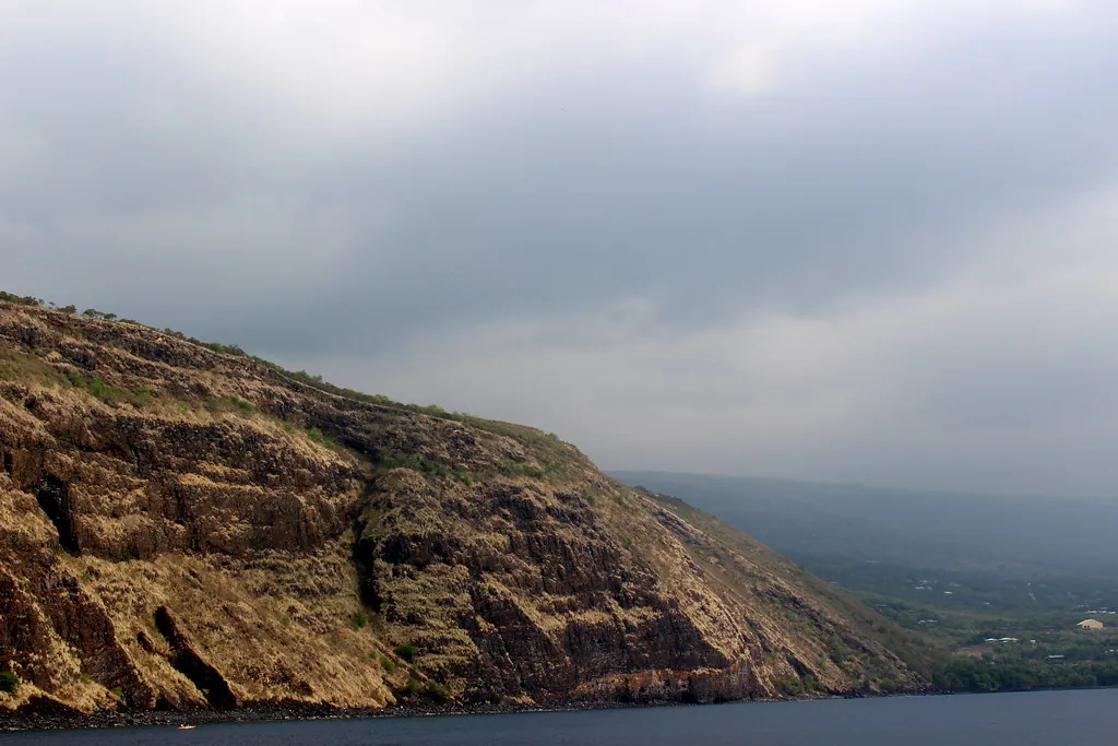
The reason is geology doing you a favour. Behind the bay rises the Pali Kapu o Keōua, a 600-foot basalt cliff that runs almost vertically from the water and shelves Kealakekua from the prevailing trade winds. Those winds come from the northeast, hit the cliff, and slide up and over rather than across. Inside the 315 ocean acres of the Marine Life Conservation District, the surface stays glassy on mornings when Honokōhau Harbor looks like a washing machine. The park above adds another 375 land acres of dry coastal terrace, protected since 1967.
Here’s the honest version of how this page works. Two decisions will make or break your visit. Which month you come, and which hour you get in the water. Everything else (the boat booking, the parking spot, the sunscreen) is downstream of those two. So let’s deal with them properly.
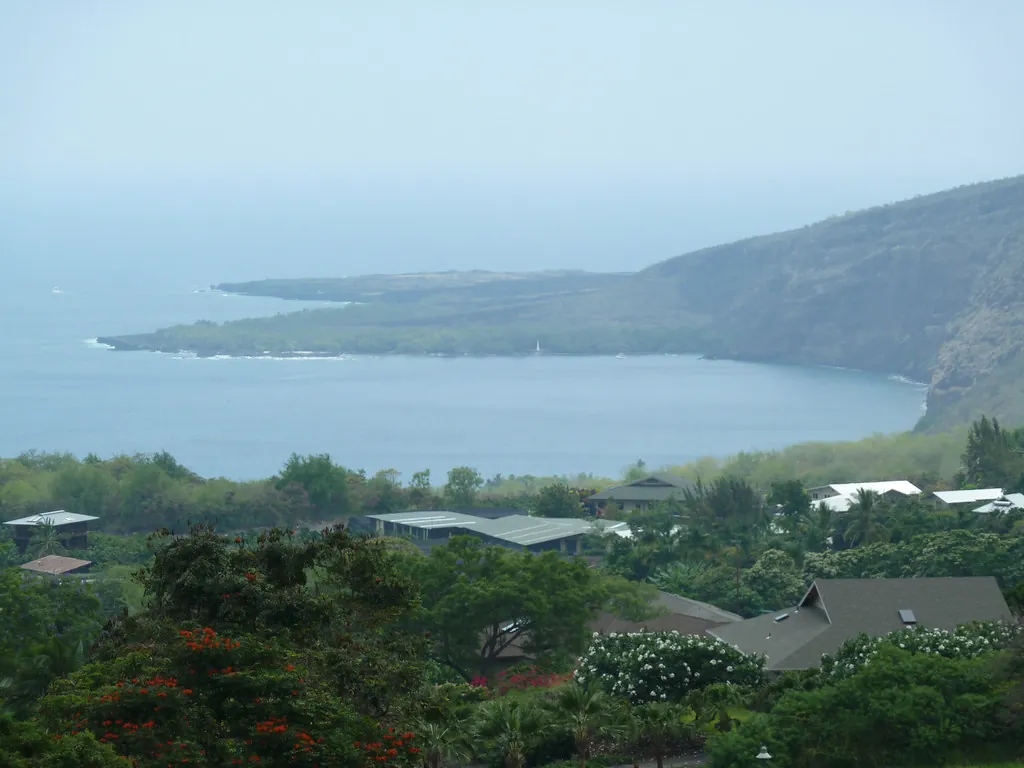
Kona’s Leeward Microclimate, Translated
Trade winds sweep in from the northeast, climb the shoulders of Hualālai and Mauna Loa, cool as they rise, and dump their moisture on the uplands. By the time the air reaches the coast it has been wrung out. That’s the rain shadow, and it’s why Captain Cook village at 1,400 feet gets properly soggy while the shoreline three miles below often stays dry enough for a picnic.
Two wet patterns interrupt the dryness. In summer, afternoon convection builds clouds over the mountain and delivers brief, heavy showers between roughly 2pm and 6pm, usually clearing by dinner. In winter, from December into February, cold fronts slide down from the northwest and give you longer, steadier rain that can hang around for a day or two. They’re different animals. Summer rain is a tap you can wait out under a lanai; winter rain is a mood.
One thing that confuses visitors no end: a forecast saying “40% showers” for Captain Cook. That means a 40% chance of measurable rain landing on at least one gauge somewhere in a forecast zone that stretches from the coast up to 2,000 feet. It does not mean 40% of your day is ruined, and it certainly doesn’t mean the bay is raining. I’ve driven down from a misty Captain Cook morning into a blazing Nāpōʻopoʻo afternoon more times than I can count. Check the National Weather Service Honolulu office for the actual discussion, then look out the window. The window usually wins.
Month-by-Month at a Glance
Air temperatures below are typical afternoon highs on the coast. Water temperatures are honest averages, not marketing. Rain risk is for the shoreline, not the mountain.
| Month | Air | Water | Rain risk | Wind / swell | Crowds | Verdict |
|---|---|---|---|---|---|---|
| January | 78°F / 26°C | 76°F / 24°C | Moderate (fronts) | NW swell, moderate | High (whales) | Good mornings, watch surge |
| February | 78°F / 26°C | 76°F / 24°C | Moderate | NW swell, strongest | High | Go early, check the jetty |
| March | 79°F / 26°C | 76°F / 24°C | Moderate, easing | Swell fading | High | Good, improving late month |
| April | 80°F / 27°C | 77°F / 25°C | Low | Calm | Medium | Excellent |
| May | 81°F / 27°C | 78°F / 26°C | Low | Trades building | Medium | Excellent |
| June | 83°F / 28°C | 79°F / 26°C | PM showers | Trades steady | Rising | Very good before 10am |
| July | 84°F / 29°C | 80°F / 27°C | PM showers | Trades 10–20 kn | High | Early only |
| August | 84°F / 29°C | 80°F / 27°C | PM showers | Trades 10–20 kn | High | Early only |
| September | 84°F / 29°C | 80°F / 27°C | Low | Trades easing | Low | Best overall |
| October | 83°F / 28°C | 80°F / 27°C | Low–moderate | Calm | Low–medium | Best overall |
| November | 81°F / 27°C | 78°F / 26°C | Moderate | First NW swells | Medium | Good, watch the trend |
| December | 79°F / 26°C | 77°F / 25°C | High (fronts) | Swell and rain | High | Flexible plans only |
January to March. Humpback season, and the reason so many people book. Water sits at a perfectly swim-able 76°F (24°C) and the early mornings are frequently mirror-flat. The catch is swell. Northwest groundswell from distant North Pacific storms rolls into the bay and heaves against the shallow basalt shelf at Kaʻawaloa, which makes the concrete jetty exit genuinely awkward. Check the surf before you commit.
April and May. My favourite stretch, quietly. Trade winds are still gentle, the winter swell has packed up, water temperatures are climbing, and the summer crowds haven’t landed. Visibility runs long. If someone asked me to pick one fortnight for a first visit and I wanted them to love the bay, I’d say the last week of April.
June to August. Reliable and busy. Trades blow hardest now, which keeps the air pleasant but chops the surface after about eleven. Afternoon showers arrive like clockwork over the mountain and rarely reach the shoreline for long. US school holidays land mid-June through mid-August, so the 9:45am to 12:30pm boat peak feels heavier than at any other time of year. Be in the water by half seven and you’ll barely notice.
September and October. The sweet spot, in my book. Trades slacken, the sea flattens, rain risk dips, and the crowds thin out noticeably once the school term starts. You get long morning windows with 100-foot-plus visibility and far fewer snorkellers in the cove. October does bring Ironman week, so accommodation in Kailua-Kona gets tight and the roads busier, but the bay itself stays calm.
November and December. A transition you can feel. Early northwest swells return, the fronts start queuing up, and conditions become day-to-day rather than week-to-week. Still worth coming. Just book something with free cancellation and keep the plan looser than you’d like.
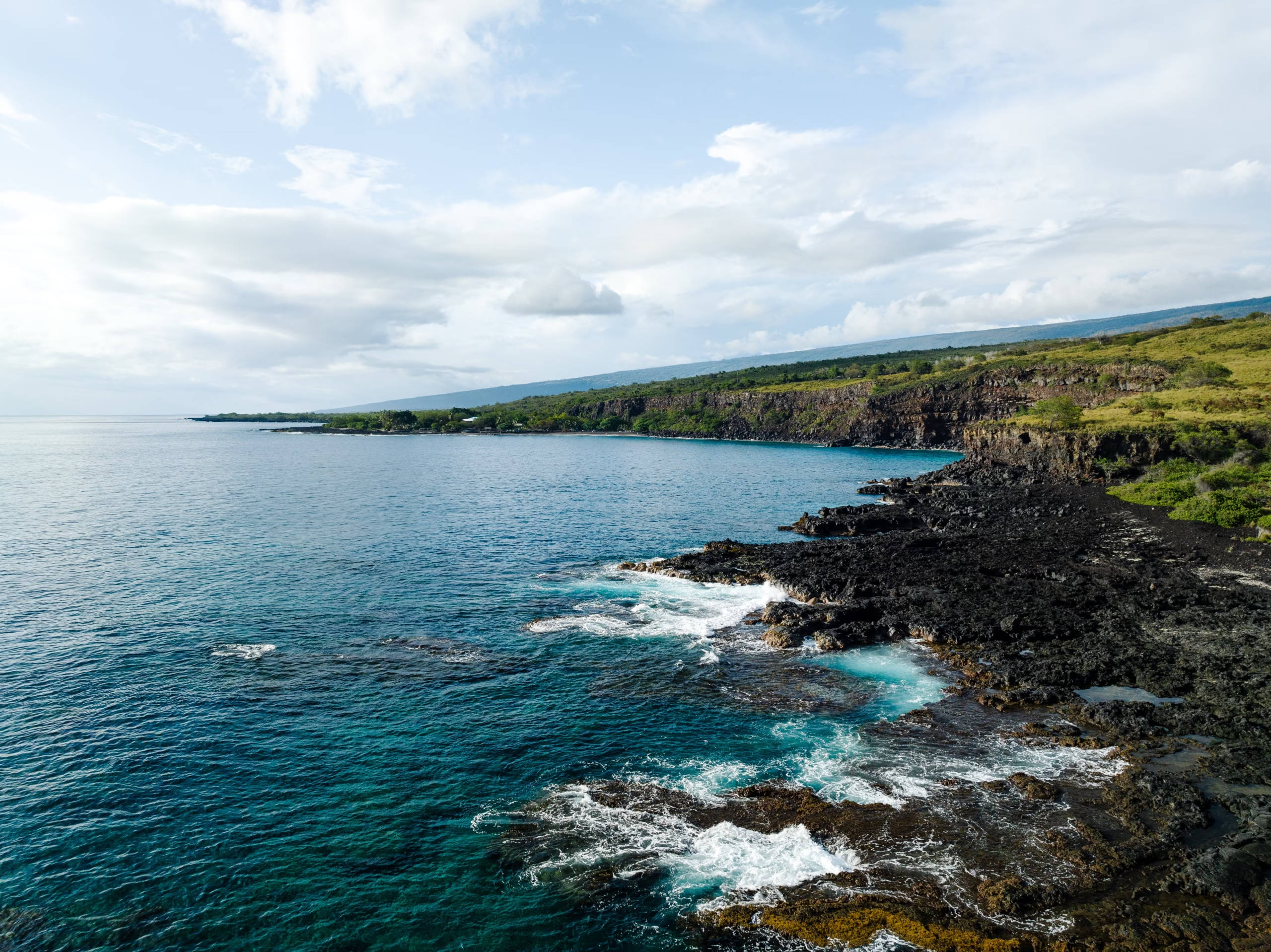
The Water Clarity Clock
This is the single most useful thing on this page, and hardly anyone plans around it. Kealakekua has a daily visibility cycle you could set your watch by.
- 6:30am to 9:00am: glassy surface, horizontal visibility of 100 to 120 feet. Snorkelling here feels like looking through gin. Fish are feeding along the reef shelf and the light is still low and silvery.
- 9:00am to 10:30am: still very good. Slight texture on the water, visibility holding above 80 feet. Boats are arriving, so the cove gets louder.
- 10:30am to 11:30am: the changeover. The Kona breeze starts to fill in from the south-west and small chop breaks up the surface film.
- Midday to 3:30pm: visibility typically drops to 40 to 50 feet. Warm upland air over the mountain slopes rises, cool marine air gets pulled onshore to replace it, and that onshore push lifts sand and sediment off the shallow shelf. You’ll still see plenty of fish. You just won’t get that endless-blue photograph in your head.
- 4:00pm to 7:00pm: the breeze often dies with the afternoon heat, the bay empties of boats, and late light hits the cliff face. Visibility improves again, though rarely back to dawn levels.
If you take one thing from this page: aim to be floating by 8am. The difference between an 8am and a noon snorkel is the difference between two entirely different bays. Full reef detail and entry points live on the snorkelling hub.
Three Weather Systems That Decide Your Day
Trade winds
Northeast, 10 to 20 knots, strongest May through September. The cliff blocks most of it inside the bay, but they govern how the rest of your day feels and how choppy the crossing from Keauhou gets.
The Kona breeze
A daily onshore thermal wind, usually filling in around 11am and dying by 4pm. It’s the reason morning clarity is a rule rather than a coincidence. Small, predictable, plan around it.
Winter NW swell
November to March, generated by storms thousands of miles north. It enters the bay and surges across the Kaʻawaloa shelf. This one is a genuine safety matter, not an inconvenience.
Practical thresholds I use, having watched a lot of people get this wrong. If white water is breaking over the second step of the Kaʻawaloa jetty, stay out: exiting in surge pushes swimmers onto volcanic ledges and into urchins, and there are no lifeguards stationed at the flats or at Nāpōʻopoʻo. If the channel markers are leaning and there’s a scum of white on the surface, the wind is up and your visibility is already gone. And if a northwest swell advisory is running, treat it as a no-swim day and go walk the trail instead. Current marine forecasts are published by the NWS Honolulu; the state rules that back them up are summarised on our visitor rules page.
The Rainiest Months (and What to Do When It Rains)
Statistically, the wettest stretch on this coast is December through February, when fronts stall against the mountain. Ask any local which month rains most in Kona and most will say January. The summer pattern is different: June, July and August bring those short, warm afternoon downpours that dump hard for twenty minutes and then steam off the pavement.
Here’s the useful bit. Rain almost never ruins a whole day here, and it rarely ruins a morning. If the sky looks grim at 9am, drive south. Puʻuhonua o Hōnaunau National Historical Park sits about fifteen minutes down the road, costs $30 per vehicle (roughly €26) and is one of the most quietly powerful places on the island; check current hours and fees at nps.gov/puho. Alternatively, park yourself on the lanai at The Coffee Shack on Highway 11 and order a lilikoi cheesecake while the cloud does its thing over the coffee trees below. The South Kona scenic drive makes an excellent wet-day loop, and the planning hub lists more indoor and sheltered options nearby.
Kona rain is usually a fifteen-minute conversation with the sky, not a lost day. Take the rain shell, wait it out, and the bay will hand you the afternoon back.
Crowds Follow the Boats, Not the Calendar
Forget seasonal averages for a moment. The single biggest variable in how Kealakekua feels at any given hour is the commercial boat timetable, and it is remarkably consistent.
The daily rhythm
- 7:00am to 9:00am: Quiet window. Hikers who left the trailhead at 6:30am are in the water before the first catamaran. Flat surface, 100-foot visibility, dolphins sometimes still resting in the bay.
- 9:00am to 10:00am: The fleet arrives. Fair Wind II, the 60-foot catamaran, checks in at Keauhou Bay from 8:15am and departs at 9:00am, mooring at Kaʻawaloa Cove roughly 9:45am to 10:00am. Rigid inflatables and commercial kayak groups come right behind.
- 10:00am to 12:30pm: Peak. Several large vessels, guided kayak flotillas and 100 to 200 snorkellers in the cove at once. Fun atmosphere if you like company, hopeless if you came for solitude.
- 1:00pm to 3:30pm: The lull. Morning catamarans head back to Keauhou between 12:30pm and 1:15pm. The cove empties. Surface chop picks up, so visibility drops, but you’ll have space to swim.
- 4:00pm to 7:00pm: Boats gone, trail traffic thin, cliff lit gold by the low sun. No snorkelling gear required to enjoy it.
Then layer the seasonal overlays on top. US school holidays (mid-June to mid-August, Thanksgiving, Christmas through New Year) add leisure traffic to every window. Whale season from December to April brings extra boats and a lot of binoculars on the cliff. Ironman week in October fills Kailua-Kona accommodation but leaves the bay calm. And weekends matter more than most guides admit: the free Nāpōʻopoʻo Beach Park lot holds only 20 to 30 vehicles and routinely fills by 9:00am on a Saturday.
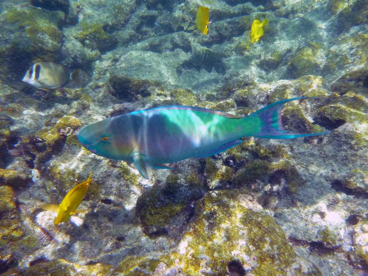
Best Window for Snorkelling
Two windows, two completely different experiences. The early one wins.
If you’re hiking down the Kaʻawaloa Trail, a 6:30am to 6:45am start puts you at the monument before 7:30am and buys you roughly two hours of quiet water. That’s the version I’d choose every time. The alternative is the midday lull, 1:00pm to 3:30pm, when the boats have gone but the breeze has arrived. You’ll have the reef more or less to yourself and about half the visibility.
Afternoon boat tours exist because they’re cheaper and easier to slot into a holiday. A typical afternoon sailing catamaran trip runs about $143.93 (roughly €133), against $193.75 (roughly €179) for a deluxe morning cruise, and the price gap is real. So is the water clarity gap. If photography or a first-time snorkeller’s wow moment matters, pay for the morning. If you just want to be in the sea with a beer on the way back, the afternoon is genuinely lovely. Compare options on the tickets and tours page.
Best Window for Kayaking and Paddling
Paddle before 11am or don’t paddle. That’s the short version. Morning water in the bay is flat enough that a moderately fit beginner can cross from Nāpōʻopoʻo to the monument in around 45 minutes without feeling like they’ve picked a fight with the Pacific. After the Kona breeze fills in, the return leg becomes a proper slog.
Permits are where people come unstuck. Private, non-commercial vessels must apply to [email protected] at least 14 days in advance, and launching from the historic Nāpōʻopoʻo concrete wharf is prohibited outright. Rental kayaks are not permitted to land at Kaʻawaloa, ever, so you snorkel tethered to your boat rather than beaching it. Only three licensed operators hold landing permits for guided groups. Buy cheap cash rentals from a pickup truck on the roadside and you’re risking a DOCARE citation and a confiscated boat. Full detail sits on the kayaking and boat access hub, with the legal specifics on the rules page.
Best Window for the Kaʻawaloa Trail Hike
Start at 6:30am to 6:45am, year round. In summer, push it earlier if you can. The descent is 1,300 vertical feet over 1.9 miles and takes 40 to 50 minutes going down, which lulls people into a false sense of their own fitness. The return is the part that bites: 60 to 90 minutes of unshaded climbing through Guinea grass with the sun directly overhead and temperatures that regularly pass 90°F.
The state park shoreline opens at 7:00am, but the trailhead sits up on Nāpōʻopoʻo Road, so an early start is normal and expected. Carry 2.5 to 3 litres of water per person plus electrolytes. Not a suggestion. There is no drinking water, no restroom, no bin and no shade at Kaʻawaloa Flats. Parking is a dirt shoulder about 1.5 miles down Nāpōʻopoʻo Road from the Highway 11 junction, at the pullout by the Middle Keei Road fork, with room for 15 to 20 cars; leave nothing visible inside, because break-ins here are opportunistic and rental cars are the target. Directions and shuttle alternatives are on the transport page.
Wildlife Timing: Whales, Dolphins, and the Rules
Humpback whales run December through April, with January to March the densest period. You don’t need a boat. From the cliff top on the Kaʻawaloa Trail or the shoreline at Nāpōʻopoʻo, breaches and blows are common enough that locals stop mid-conversation to point. NOAA’s Hawaiian Islands Humpback Whale National Marine Sanctuary publishes approach rules at hawaiihumpbackwhale.noaa.gov.
Spinner dolphins use the bay to rest in the mornings, which is exactly when you’re most likely to be in the water with them. Resist. Federal law requires 50 yards of distance from marine mammals, and violations can carry penalties up to $10,000. Tour operators who chase dolphins are not your friends. If a pod is circling slowly and logging at the surface, they’re sleeping, and the kind thing is to swim away from them. More on reading currents and marine etiquette sits on our Hawaii snorkelling safety guide.
What to Pack, Month by Month
One quirk that catches out first-timers: you may well snorkel in 80°F water in the morning and then drive up to 1,400 feet for coffee in 62°F drizzle that afternoon. Layers earn their luggage space.
| Item | Why it matters | Peak months |
|---|---|---|
| Long-sleeve rashguard | Sun protection without sunscreen sloughing off into the reef; mineral-only sunscreen is the standard here | Year round, vital Jun–Sep |
| Reef-safe mineral sunscreen | Oxybenzone and octinoxate are banned in Hawaii waters; zinc or titanium dioxide only | Year round |
| Trail shoes plus dive booties | Loose basalt scree on the descent, urchins and rock at the jetty entry | Year round for hikers |
| Packable rain shell | Afternoon convection or a stalled winter front, depending on season | Dec–Feb, Jun–Aug |
| Warm layer for the uplands | Coffee country sits 1,400 feet above the bay and runs 12–15°F cooler | Nov–Mar |
| 2.5–3 L water plus electrolytes | Non-negotiable for the Kaʻawaloa climb; no water source at the flats | Peak need Jun–Oct |
| Dry bag | Boat spray, kayak splash, and keeping the car visibly empty of valuables | Year round |
You get two decisions at Kealakekua: which month, and which hour. Choose the hour well and the month forgives almost anything.
Booking Around the Weather
Morning departures are worth real money here, for the reasons already covered. Beyond that, look for free cancellation as your weather insurance. Operators running out of Keauhou Bay and Honokōhau Harbor cancel or reschedule for swell and wind fairly often in winter, and a flexible policy turns a washed-out Tuesday into a Thursday morning with 110-foot visibility.
Check three things the evening before: the NWS Honolulu marine forecast, the current swell direction and period, and the DLNR Division of State Parks page at dlnr.hawaii.gov/dsp.
The Short Answer
Best overall months for Kealakekua Bay weather: September and October first, April and May a close second. Best hour in the water: 7:00am to 10:30am, no argument. Worst combination: a late-morning arrival in a January northwest swell, on a Saturday, after 9am, when the Nāpōʻopoʻo lot is full and the jetty is surging.
Day-use entry to the park is free ($0.00 / €0.00) and the gates run 7:00am to 8:00pm. Bring cash-free patience for parking, carry your water down and your rubbish back up, and if the conditions look marginal, trust the cliff and the white water over the forecast. Then get in early, float, and let the bay do the rest.