Best Months for Snorkeling in Hawaii: Water Clarity, Crowds, and Weather
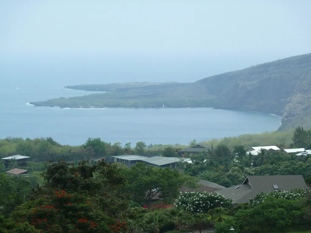
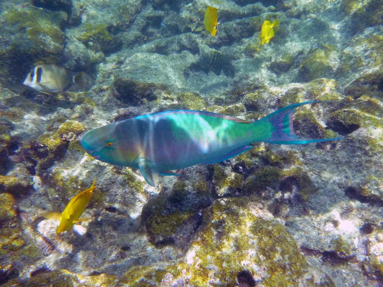
First light on the Kona coast, mid-October, and I am standing on the jetty at Kaʻawaloa with Old Faithful (my mask, held together by habit and one replacement strap) pressed to my face. The bay is flat. Not calm-flat, but mirror-flat, the kind of surface that makes the cliff behind me look doubled. I get in, put my face down, and the reef appears from about forty feet away with the suddenness of a light being switched on. Horizontal visibility that morning was somewhere near 110 feet. By 11:30 AM it was half that, because the Kona breeze had woken up and started ruffling the surface.
That single morning explains this entire article. Snorkelling in Hawaii is not really about which month you book. It is about which hours you book, inside a month that is doing roughly what you hoped. Get the season right and you have tilted the odds. Get the time of day right and you have actually won.
The Short Answer: A Month-by-Month Verdict Table
Here is the whole argument compressed into one grid. Read it, pick your window, then come back for the reasons.
| Month | Water Clarity | Swell Risk | Rain | Crowds | Verdict |
|---|---|---|---|---|---|
| January | Excellent between swells | High | High | Moderate | Great water, gamble on the forecast |
| February | Excellent between swells | High | High | Low | Whale season bonus, watch the buoys |
| March | Very good | Moderate to high | Moderate | High late month | Spring break spoils the edges |
| April | Very good | Falling | Moderate | Low after mid-month | Quietly one of the best |
| May | Excellent | Low | Low | Low | My pick for value and clarity |
| June | Excellent mornings | Low | Low | Rising | Go early, hard stop at 11 AM |
| July | Excellent mornings | Low | Low | Peak | Smoothest seas, most people |
| August | Very good | Low, storm-watch | Low | Peak | Calm but humid and busy |
| September | Very good | Low, storm-watch | Low | Low | Warm water, thinning crowds |
| October | Very good | Rising late month | Moderate | Lowest | Warmest sea, emptiest reef |
| November | Good to excellent | Rising | Moderate | Low pre-holiday | Underrated until Thanksgiving |
| December | Good between swells | High | High | Very high | Holiday crush plus north swell |
One money note before you go any further. Afternoon snorkel charters at Kealakekua frequently sell for $20–$40 less than the morning departures, and there is a reason. You are buying the windy half of the day. If the discount is the only reason you are booking at 2 PM, read the section on the midday lull first and decide whether choppy water is a fair trade for the saving. You can compare the departures side by side on the tickets and tours page.
How Hawaii’s Two Seasons Actually Work (Kau and Hoʻoilo)
Hawaiian tradition splits the year into two rough halves, and the split is genuinely useful for planning. Kau (say “kow”) is the dry season, roughly May to October. Hoʻoilo (say “hoh-EE-loh”) is the wetter, cooler stretch from November through April. Two things about this surprise visitors constantly.
The first is that Hoʻoilo is not a washout. It means more rain on average, not rain every day, and the showers tend to arrive in passing squalls rather than settling in for a week. The second is that rain is rarely what shuts a snorkel day down. Two engines do that, and neither is cloud.
- North Pacific groundswell (winter). Storms tracking across the north Pacific push long-period swell south, and it wraps into west-facing bays. This is the one that produces surge, poor visibility and dangerous exits.
- Trade-wind chop (summer afternoons). The north-east trades are reliable and mostly welcome, because they keep the air bearable. By early afternoon they have textured the sea surface, which halves your horizontal view.
For swell, I check the National Weather Service Honolulu forecast office before I commit to a morning, and I look at the buoy readings rather than the wind widget on my phone. Local rain patterns are a separate question, and the leeward coast plays by its own rules entirely.
What “Water Clarity” Really Means (and What Kills It)
“Crystal clear” is a marketing phrase. Horizontal visibility is a measurement. When someone tells you Kealakekua Bay snorkelling is world class, what they actually mean is that on a settled morning you can see a hundred feet sideways, which is roughly the length of three London buses laid end to end. That is the honest metric, and it moves hour to hour.
Four things degrade it, in order of how often they ruin my plans.
- Sediment runoff after rain. Water sheets off the steep South Kona slopes and carries fine soil into the bay. It clears in a day or two, but that day or two matters.
- Swell surge on the shallow reef. Even a modest groundswell stirs sand and basalt grit off the shelf at Kaʻawaloa. Visibility drops, and the exit gets interesting.
- Plankton blooms. Warmer water and nutrients bring a green haze. Harmless to swim in, mildly annoying to photograph.
- Afternoon wind chop. The most predictable of the four, and therefore the most avoidable.
A realistic benchmark from my home reef: 100 to 120 feet of horizontal visibility on a glassy 7 AM start, falling to 40 to 50 feet by late morning once the Kona breeze fills in from the south. Both of those are perfectly good snorkel conditions. One is a memory. The other is a nice swim.
On a still morning the water is like looking through gin. By eleven o’clock it is more like looking through gin and tonic, and the ice has started to melt.
Kona’s Leeward Trick: Why the Big Island’s West Side Cheats
Hilo, on the windward side, receives well over 100 inches of rain a year. Kailua-Kona and South Kona, sitting in the rain shadow of Mauna Loa and Hualālai, get a fraction of that, and the difference is not subtle. Drive from Kona to Hilo and you pass through roughly five climate zones in two hours.
Kealakekua Bay gets a second layer of protection. Pali Kapu o Keōua, the 600-foot cliff on the north side, acts as a windbreak for the cove, which is why Kaʻawaloa can be mirror-flat while the open coast a mile away is chopped up. That geography is the reason this bay is a Marine Life Conservation District rather than just a pretty inlet.
Practical translation: Kona is the safest wet-season bet in the state. If you are visiting in January and you only have one snorkel day, spend it on the leeward Big Island rather than gambling on the north shore of Kauaʻi. The finer detail on local conditions sits on our best time and weather hub, which is the page to read once you have picked your month.
Island-by-Island Comparison
Different islands, different failure modes. Here is how I would rank them for a dedicated snorkel trip.
| Island / Site | Best Window | Main Weak Spot | Verdict |
|---|---|---|---|
| Oʻahu — Hanauma Bay | Year-round, booked slots | Timed entry, two closed days a week, windward swell exposure | Superb reef, logistics-heavy; reserve well ahead via the City and County of Honolulu |
| Maui — Molokini Shoal | May to September mornings | Channel crossing is rough whenever trades pick up | Clarity is exceptional, but you are booking a boat ride and a weather window together |
| Kauaʻi — North Shore | May to September | North swell shuts sites from October to April | Seasonal and dramatic; use Poʻipū in winter instead |
| Big Island — Kona coast | Any month, mornings | Winter groundswell, afternoon wind | Best year-round baseline in Hawaii, full stop |
| Big Island — Windward (Hilo, Hāmākua) | Rare good days | Rain, runoff, exposed coastline | Not a snorkel destination; enjoy the waterfalls instead |
Winter (November–March): Best Visibility, Worst Odds
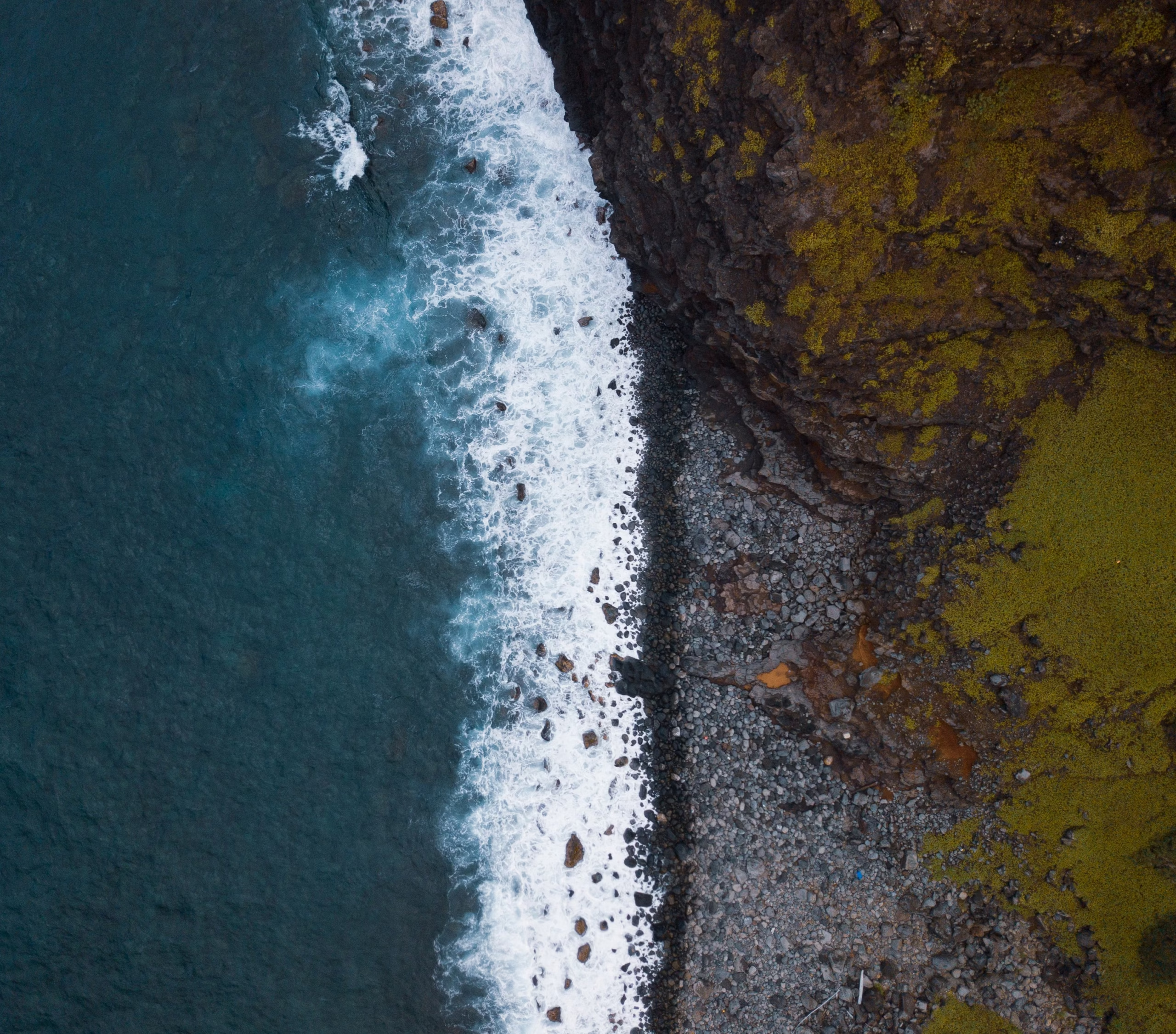
Between swells, winter water is the clearest of the year. Cold, dense, settled, and superb. The trouble is the gaps between those swells get shorter and less predictable, and a northwest groundswell entering Kealakekua generates surge right across the shallow basalt shelf at Kaʻawaloa.
Two safety facts I will not soften. There are no lifeguards stationed at Kaʻawaloa Flats or at Nāpōʻopoʻo Beach. And when there is heavy surge, the concrete jetty exit can push you onto volcanic ledges, which is how people end up with deep lacerations and sea urchin spines in their hands. If the surge is running, do not get in. The bay closes at 8:00 PM and will still be there tomorrow.
Compensation for the risk: humpback whales, roughly December through April, and the smallest crowds outside the holiday fortnight. Christmas to New Year is the exception, when the Kona coast fills up and prices climb accordingly. Our visitor rules page covers the conservation-district regulations in full, and it is worth ten minutes before you book anything.
Spring (April–May): The Underrated Window
Swell fades, the trades have not yet locked in, and the water is warming without the summer crowds. This is the stretch I recommend to friends who want a good trip without paying peak-season rates. Tour prices soften too, often by €20–€30 (~$22–$33) on the same morning departures that sell out in July.
The caveat is spring break. Mid-March to early April brings a genuine surge of family travel, and the early-morning quiet window at Kealakekua fills faster than usual. Push your trip to the second half of April if you can and the difference is noticeable.
Summer (June–August): Calm Water, Peak People
Smoothest seas of the year, warmest water, easiest conditions for children and nervous swimmers. Also the busiest. Mainland school holidays land squarely on the Kona coast, and the commercial catamaran schedule reflects it.
Here is the crowd pattern with actual timings, because vague warnings are useless. The big vessels, led by the 60-foot Fair Wind II, leave Keauhou Bay between 8:30 and 9:00 AM and moor in Kaʻawaloa Cove around 9:15 to 9:30. Smaller rigid inflatables and guided kayak groups pile in immediately afterwards. Between 9:45 AM and 12:30 PM you can be sharing the cove with 100 to 200 snorkellers.
The workaround is the early window. Hikers who start down the Kaʻawaloa Trail between 6:30 and 6:45 AM reach the monument before 7:30 and get roughly two hours of glassy, uncrowded water with the reef fish still feeding. If you would rather not hike 1,300 vertical feet before breakfast, book the earliest boat departure you can find and accept a shorter quiet period. A small-group Zodiac trip typically reaches the bay ahead of the catamarans because it moves faster and carries fewer people.
Hurricane Season (June–November) and the Post-Storm Rule
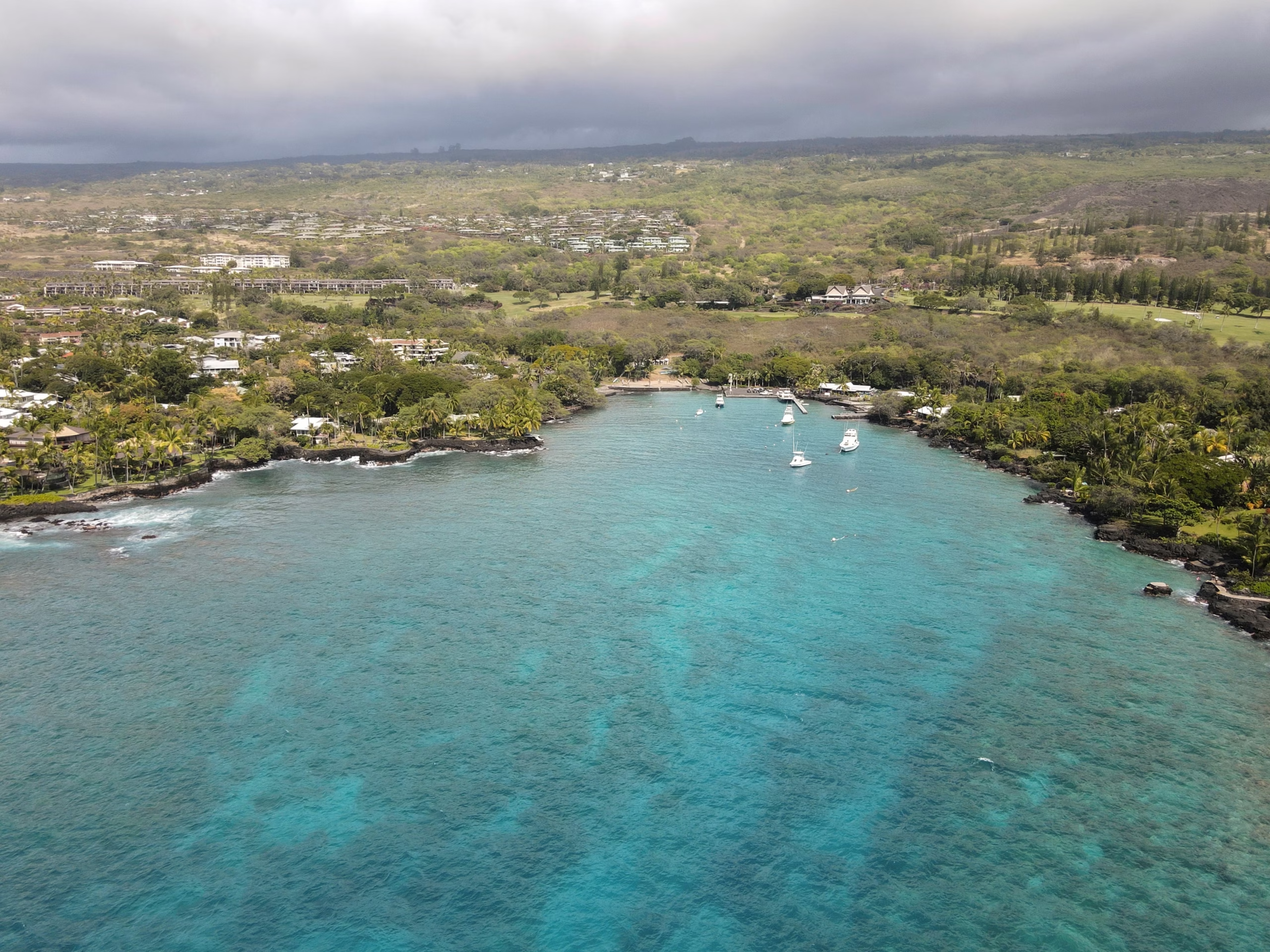
Peak risk runs from late July through September, with August and September the most active months. Direct hits are rare, and I have never felt unsafe on land during a named storm here. What actually disrupts snorkelling is the tropical moisture that gets dragged in around a passing system, dumps several inches of rain on the slopes in an afternoon, and sends soil straight into the bay.
So use the 24-to-48-hour rule. After heavy rain, expect clarity to crash, then recover. Two days is usually enough for sediment to settle out of a sheltered bay like Kealakekua. Brown-water plumes are visible at Nāpōʻopoʻo and Manini Beach after storms, and if you can see the plume, do not swim through it. Track systems properly through the Central Pacific Hurricane Center rather than a phone app’s coloured blob.
Autumn (September–October): Warmest Water, Fewest People
Ocean temperatures tend to hit their annual high around September and early October, and the commercial tour load drops off a cliff once the school holidays end. Glassy mornings appear between swells. On the day I am writing this, in mid-October, the water is bath-warm and the cove has been almost empty at 7 AM, though I would not stake a booking on any single week of autumn weather.
The trade-off is afternoon convection. Clouds build over the mountain through the morning and release in the early afternoon, which is fine if you are an early riser and mildly irritating if you are not. Pack a light rain shell and treat the showers as a free freshwater rinse.
Tides, Moon Phase, and the Time-of-Day Effect
The daily cycle at Kealakekua is more reliable than any seasonal forecast. Learn it once and you will snorkel better on every island in the chain.
- 7:00–10:30 AM: glassy water, full visibility, fish feeding. The best window by a wide margin.
- 10:30 AM–1:00 PM: the sea breeze kicks in onshore from the west-southwest, surface chop builds, visibility halves. The noisiest period in every sense.
- 1:00–3:30 PM: the midday lull. Morning catamarans clear out of Kaʻawaloa between 12:30 and 1:15 PM, leaving the cove quiet. Water is choppier than dawn, but you will have room to swim.
- 4:00–7:00 PM: all commercial craft gone, trail traffic thinned, low sun lighting the face of Pali Kapu o Keōua. Lovely for photographs, and hikers still need to climb out in the heat.
Moon phase matters less than people think, but it does move water. A full or new moon brings a bigger tidal range, which means stronger flow around the headland at Kaʻawaloa. Plan your entry and exit points around slack water if you can, and never plan a long swim out when the tide is pushing against you on the return.
What Goes in My Dry Bag, Season by Season
Year-round kit
Reef-safe sunscreen (the only kind that belongs in a conservation district), a rash vest, 2.5 to 3 litres of water per person for the trail, electrolytes, and a dry bag for keys and phone. Leave the valuables in the hotel safe entirely; the shoulder parking at the Kaʻawaloa trailhead is an unmonitored smash-and-grab target and rental cars get singled out.
Seasonal additions
Winter: a 3mm shorty, because forty-five minutes in February water eventually registers. Summer: a light long-sleeve for the boat, since the sun on an open deck is unforgiving. Autumn: a packable rain shell for those afternoon convection showers. All year, a lightweight hoodie for the 7 AM drive up Highway 11.
One more piece of local knowledge worth having before you plan around conditions: not many visitors realise that unlicensed vendors along Nāpōʻopoʻo Road still sell cash kayak “rentals” on the promise that you can land at the monument. You cannot. Unguided rental kayaks are prohibited from landing at Kaʻawaloa, and DLNR enforcement officers do patrol. Licensed operators display permit decals on both sides of the bow, so check before you hand over money.
Putting It Together
If you want a single recommendation: late April, May, September or October, booked for a morning departure, with a spare day in your itinerary in case a swell arrives. That combination gives you warm water, manageable crowds, settled seas and pricing that has not been inflated by school holidays. If you are locked into July, go anyway and start at 7 AM. If you are locked into January, watch the buoys for two days beforehand and be prepared to swap the bay for a coffee farm drive instead.
The full picture of what to expect underwater, including which parts of the reef suit which swimmers, lives on our snorkelling and marine life hub. For currents, entry technique, seasickness and the people who should genuinely skip a snorkel day, read the Hawaii snorkelling safety guide. And if you are still weighing whether to swim independently or join a licensed operator, the Kealakekua Bay FAQ answers that one in a single sentence.
Planning further out? The plan your visit hub covers lodging, facilities and how to combine a bay morning with the rest of South Kona, and the Hawaii Visitors and Convention Bureau keeps the statewide event calendar that explains half the crowd spikes in this article.